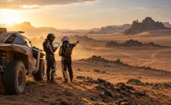
Imagine racing across an empty desert at more than 100 km/h while your navigator tells you to leave the obvious track, aim toward a barely visible valley, and search for a waypoint you cannot yet see on the GPS.
That is normal Dakar Rally navigation. Unlike everyday satellite navigation, Dakar competitors are not simply following a highlighted route from start to finish.
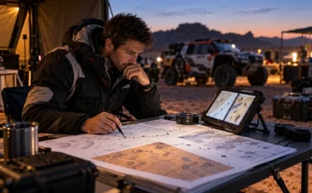
The organisers provide a roadbook containing distances, diagrams, headings, landmarks, dangers, and navigation instructions that crews must interpret while travelling at racing speed. The actual route remains secret until the roadbook is released for the stage.
Modern technology has changed the interface, but not the difficulty. Dakar’s competitor information states that the fleet uses electronic roadbooks, while systems such as the ERTF Unik platform combine roadbook information with GPS and safety functions.
Understanding how Dakar Rally navigation works with complex digital roadbooks therefore means understanding a fascinating combination of technology, geography, concentration, and human judgement.
1. A Dakar Digital Roadbook Is Not Normal GPS Navigation
The easiest mistake is to imagine the Dakar roadbook as Google Maps for racing.
It is almost the opposite.
Regular navigation software already knows the route and continuously tells you where to turn. A rally-raid roadbook gives competitors a sequence of instructions that they must interpret themselves.
A typical instruction, often called a roadbook note or box, combines several pieces of information.
It may show the total distance from the beginning of the selective section, the distance since the previous instruction, a simplified diagram of the terrain, a CAP heading, and symbols describing hazards or landmarks.
The navigator connects these clues with what is actually visible outside.
A track shown in the diagram might split into three tracks in reality. One may look wider and faster, while the correct route could be the faint path heading toward a distant ridge.
That uncertainty is intentional. Navigation is part of the competition rather than merely a support system.
2. Digital Roadbooks Turn Hundreds of Notes Into a Live Workflow
Moving from paper roadbooks to electronic displays changed how crews interact with all that information.
Dakar’s current competitor information says the fleet is equipped with an electronic roadbook.
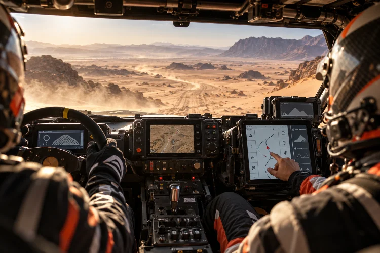
The Unik4 system introduced electronic roadbook functionality alongside GPS and Sentinel safety features, with its display showing information such as speed, total and partial odometer readings, roadbook instructions, and waypoint data.
Instead of physically rolling a paper scroll, the crew can move through digital notes using controls inside the cockpit.
The ERTF guide describes functions for advancing or reversing roadbook notes, crossing completed instructions out, adjusting odometer values, and moving between waypoints.
That sounds convenient, but it also requires precise timing.
Advance the roadbook too early and the navigator may begin reading the wrong instruction. Leave the previous note on screen too long and the crew can overshoot the next junction.
Digital technology removes some manual hassle. It does not remove the need for intense concentration.
3. Distance Is the Navigator’s First Reference Point
Distance is one of the foundations of Dakar navigaton.
Every roadbook instruction is tied to kilometre measurements. The navigator constantly compares the roadbook distance with the vehicle’s odometer to determine when the next instruction should appear.
Suppose the roadbook says there is a track junction at kilometre 184.35.
As the vehicle approaches that number, the navigator starts searching for the physical feature shown in the diagram. The driver may receive instructions such as “junction in 300 metres,” followed by the required direction or heading.
Things become complicated when the actual odometer and roadbook distance stop matching perfectly.
Wheelspin, detours, navigation corrections, or GPS measurement differences can create small discrepancies. Electronic systems therefore allow crews to adjust odometer information so that upcoming instructions remain synchronized with the route.
Being wrong by only a few hundred metres can become a serious problem when several similar tracks appear close together.
4. CAP Headings Help Crews Navigate Where Roads Disappear
Some Dakar sections contain almost no traditional roads.
That is where CAP headings become essential.
A CAP is essentially a compass heading expressed in degrees. Instead of saying “follow the road,” the roadbook might tell the crew to leave the existing track and travel toward a specific heading across open terrain.
The electronic navigation display can show the heading currently being followed, while waypoint functions may provide additional directional information once the relevant navigation conditions are met.
The Unik4 interface, for example, includes COG – or course followed – as well as target-waypoint information.
This becomes especially important in dunes, dry lake beds, and wide valleys.
There may be dozens of tracks from other competitors going in slightly different directions. A navigator cannot simply follow the most obvious one.
A strong crew compares the roadbook diagram, distnace, terrain, CAP, and tracks simultaneously before deciding where to go.
5. Waypoints Prevent Competitors From Simply Taking Shortcuts
Waypoints are virtual geographical checkpoints stored inside the official navigation system.
Their role is crucial because the Dakar often crosses open terrain where competitors could theoretically choose many different lines.
The FIA uses several waypoint types, each with different rules.
For example, the 2026 Cross-Country Rally Sporting Regulations list the WPM, or masked waypoint, with an opening radius of 800 metres and a validation radius of 90 metres.
The GPS only begins directing the competitor toward the point after the vehicle enters its opening radius.
A WPN, or navigation waypoint, can be used specifically to prevent competitors from avoiding difficult areas such as dune fields. Under the same regulations, missing a WPN carries a time penalty four times higher than missing other navigation waypoints.
Other types include eclipse, safety, control, and passage waypoints.
The important idea is that the GPS does not automatically reveal everything from kilometres away.
Crews first have to navigate close enough using the roadbook.
6. The Navigator Has to Read the Terrain, Not Just the Screen
Digital equipment can provide numbers with perfect accuracy while the crew still gets lost.
Why?
Because Dakar navigation requires interpretation.
A diagram might show a main track turning right beside a smaller trail. In reality, wind, rain, erosion, or previous competitors may make both tracks look completely different.
The landscape can also contain dozens of nearly identical junctions.
That is why experienced navigators constantly connect digital information with physical clues such as valleys, vegetation, electricity pylons, buildings, mountain shapes, dry riverbeds, and changes in surface.
Tracks made by other competitors provide another clue, but following them blindly is dangerous.
The car in front may already be lost.
Carlos Sainz provided a clear example during Dakar 2026 when several competitors struggled to locate a waypoint.
He described repeatedly searching for the route during a difficult navigation section, showing how even the world’s most experienced crews can lose substantial time despite sophisticated equipment.
7. Driver and Co-Driver Communication Happens at Racing Speed
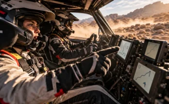
In car categories, the navigator is processing the roadbook while the driver concentrates on keeping the vehicle under control.
That creates an enormous communication challenge.
The navigator cannot simply read every piece of information aloud. Instructions have to be short, timed correctly, and delivered early enough for the driver to react.
A typical sequence might include the distance to the instruction, the direction, the required CAP, and any danger warning.
The timing changes with speed.
At 50 km/h, the crew has several seconds to react to a junction 100 metres ahead. At 140 km/h, that same seperation disappears extremely quickly.
Experienced partnerships develop their own rhythm and vocabulary.
Former motorcycle racer Brett Cummings described adapting to co-driving in Dakar as a completely different challenge because of the number of tracks, canyons, and the speed at which navigation decisions have to be made.
The best crews almost sound conversational even while processing information continuously.
8. Danger Symbols Are Just as Important as Directions
The roadbook does more than tell competitors where to go.
It also tells them what may be waiting ahead.
Standardised rally-raid symbols can warn crews about major drops, rocks, holes, dangerous crossings, narrow passages, difficult terrain, or other hazards.
These instructions are especially important because drivers cannot always see the danger early enough themselves.
A navigator might warn the driver about a severe hazard several hundred metres in advance, allowing enough time to reduce speed.
This is one reason digital roadbooks have to remain instantly readable despite containing so much information.
The navigator may be balancing direction, kilometre measurements, CAP headings, terrain notes, waypoints, and danger symbols within the same few seconds.
Missing one small symbol can have much larger consequences than missing a turn.
9. The Route Stays Secret Until the Last Possible Moment
Another important part of the system is information control.
Dakar does not want professional teams mapping every corner weeks before the rally.
The official race description states that roadbooks are distributed at the start of each stage so the course remains secret beforehand.
Current FIA roadbook requirements also specify a different roadbook for every stage, while electronic roadbooks can be unlocked through codes provided around the start procedure.
That changes preparation completely.
Teams can study navigation techniques, train co-drivers, understand terrain types, and practise interpreting the official roadbook language.
They cannot simply memorise tomorrow’s route.
When the stage begins, crews have to solve the navigation problem in real time.
That uncertainty is one of the reasons Dakar navigation remains difficult even as digital equipment becomes increasingly sophisticated.
Digital roadbooks have modernised Dakar navigation, but they have not turned the rally into a simple GPS-guided race.
Competitors still have to combine kilometre readings, roadbook diagrams, CAP headings, waypoint rules, terrain clues, danger symbols, and real-world tracks while moving at extraordinary speeds.
The GPS intentionally reveals certain information only when crews navigate close enough to the correct point, keeping human interpretation central to the competition.
That is what makes rally-raid navigation so fascinating. Technology provides better tools, but the navigator still has to make the correct decision.
The next time you watch a Dakar stage, pay attention when a leading crew suddenly slows, changes direction, or disappears away from obvious tracks. They may not be lost at all – they may simply be solving the digital roadbook one instruction at a time.