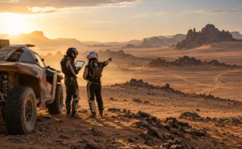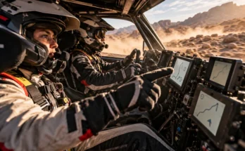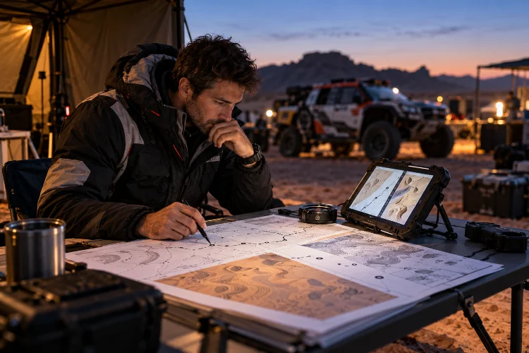
Reading a Dakar roadbook looks simple until you try doing it while a rally car is bouncing across rocks, dunes, and open desert at racing speed.
A navigator is not just reading arrows. They are constantly comparing distance, CAP headings, terrain features, waypoint logic, tracks made by other competitors, and the next several instructions.
One wrong interpretation can cost minutes, even if the driver has been among the fastest competitors all day. That is why advanced roadbook reading is really about building a reliable decision-making system.
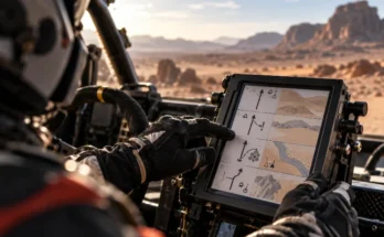
Modern Dakar navigation also uses standardized FIA roadbooks, electronic displays, and controlled waypoint information rather than ordinary turn-by-turn GPS guidance.
The roadbook remains a central part of the competition, and Dakar itself provides dedicated lexicons and training material because competitors must learn its specific visual language.
The following advanced roadbook reading techniques for Dakar Rally navigation explain how experienced crews turn complicated notes into fast, accurate decisions.
1. Read One Note Ahead, but Think Several Notes Ahead
Beginners often focus entirely on the instruction currently approaching.
Experienced navigators build a wider mental picture.
If one note shows a right turn followed only 600 metres later by an off-track section, the navigator needs to understand both before the first instruction is completed. Otherwise, there may be almost no time to prepare the driver for the second change.
This is especially important on fast terrain.
At 120 km/h, a vehicle covers roughly 33 metres per second. Six hundred metres can disappear in about 18 seconds.
Advanced roadbook reading therefore uses a layered approach: confirm the current note, prepare the next one, and maintain awareness of what follows after that.
The goal is to avoid being surprised by the roadbook.
2. Use Total and Partial Distance Together
Distance is the backbone of rally-raid navigation.
The roadbook provides cumulative distance while individual notes may also include the interval from the previous instruction. Experienced navigators use both numbers instead of depending on only one.
For example, imagine the next junction is listed at kilometre 184.70 and should appear 1.25 kilometres after the previous note.
If the total odometer looks slightly wrong but the partial distance matches perfectly, that gives the navigator another useful clue. If neither number matches, the crew knows something may already be wrong.
Electronic Dakar navigation systems also allow odometer adjustments, including changes to total and partial readings.
The advanced technique is not simply correcting the distnace whenever something looks unusual.
The navigator should first ask why the mismatch exists. Wheelspin, a short detour, or an earlier correction may explain it. Understanding the cause helps prevent one bad adjustment from creating several new errors.
3. Treat CAP as Confirmation, Not a Replacement for the Roadbook
CAP headings are extremely useful when roads become vague or disappear completely.
A CAP is essentially the compass direction in which the vehicle is travelling. Navigation equipment can also show information such as COG, or course over ground, and directional guidance when certain waypoint conditions are met.
The mistake is relying on CAP alone.
A heading of 245 degrees does not automatically mean every track pointing southwest is correct. The navigator still has to match the roadbook drawing, kilometre position, terrain description, and upcoming waypoint.
Experienced crews use CAP as confirmation.
If the roadbook says leave the main trail, cross open ground at CAP 245, then enter a valley, the navigator should look for all three elements rather than simply watching the number.
This becomes especially important when many tyre tracks are visible.
Tracks can be misleading. CAP provides another referance, but it should remain part of a larger interpretation.
4. Learn to Distinguish Useful Tracks From Dangerous Tracks
Following tyre marks is one of the easiest ways to navigate quickly in Dakar.
It is also one of the easiest ways to follow someone else’s mistake.
Later starters often have the advantage of visible tracks from competitors ahead. Road openers do not. During Dakar 2026, Henk Lategan described a particularly difficult stage where rain had washed away many small tracks and there were no motorcycle tracks to guide him.
Navigator Brett Cummings had to interpret the route largely without that extra visual assistance.
Advanced navigators therefore classify tracks mentally.
A track becomes more convincing when it matches the roadbook distance, diagram, CAP, and terrain. If only the tyre marks agree while the rest of the information does not, suspicion should increase immediately.
This prevents the classic group-navigation problem where several competitors all follow the same wrong line.
Tracks are evidence.
They are never proof.
5. Understand Waypoint Logic Before the GPS Helps You
A strong Dakar navigator knows what type of waypoint is coming before reaching it.
That matters because different waypoints provide different levels of GPS assistance.
A Control Way Point, for instance, is designed to verify whether competitors respected the roadbook while providing virtually no directional navigation beyond basic waypoint identification.
Other types can become visible or provide directional information only after competitors enter specific areas.
FIA regulations also require roadbooks to list waypoints without simply handing competitors unrestricted coordinates. Each stage receives its own roadbook under standardized rules.
Advanced navigation therefore means anticipating how the GPS will behave.
The crew should know whether it is expecting roadbook-only navigation, an eventual directional arrow, or a waypoint validation zone.
Waiting for the device to “tell you where to go” is often already too late.
The roadbook gets the crew into the right area. The electronic system then confirms what the rules allow it to confirm.
6. Build a Fast Terrain-Matching Routine
The roadbook is symbolic.
The desert is messy.
A clean diagram might show one main track, a smaller track on the left, and a dry riverbed beyond it. Outside the windshield, the same location may contain dozens of tyre marks, erosion channels, bushes, rocks, and multiple trails.
Advanced readers learn to reduce the scene to the elements that matter.
A useful mental routine is to compare four things: distance, direction, road shape, and one distinctive terrain feature.
If all four agree, confidence is high.
If three agree but one looks strange, the crew may continue cautiously. If only one or two fit, the navigator should question the route before travelling too far.
This is where experience becomes incredibly valuable.
Brett Cummings has described Dakar car navigation as a different challenge because of the huge number of tracks, canyons, and the speed at which decisions must be made.
He noted that as his partnership with Lategan developed, their mistakes became progressively smaller. Good roadbook reading becomes faster because the navigator learns what information can be ignored.
7. Separate Danger Information From Direction Information
Roadbook notes are not only about navigation.
They also protect the crew.
A single instruction can include a direction change while also warning about a hole, drop, rocky section, or another significant danger.
Advanced navigators process those two elements seperately.
First, the driver needs enough warning to understand the hazard. Then comes the directional instruction required after or around it.
Mixing everything into one rushed sentence can overload the driver.
For example, saying “big danger, brake, then right after the ditch” is often easier to process than delivering several roadbook symbols in one long call.
This is particularly important at high speed because reaction distance increases quickly.
The navigator’s job is not to repeat everything visible on the roadbook. It is to convert visual data into an instruction the driver can actually use.
8. Develop a Recovery Procedure Before You Get Lost
Even elite crews make navigation mistakes.
The difference is often how quickly they recover.
Carlos Sainz encountered exactly this problem during Dakar 2026 when he and several competitors struggled to locate the correct route around a waypoint, repeatedly turning while searching for the way through.
Advanced navigators use a structured recovery process rather than immediately chasing random tracks.
The first question is usually: when was the last roadbook note we definitely understood?
From there, the crew can compare total distance, partial distance, CAP, and terrain. If necessary, they return toward the last confirmed location instead of continuing deeper into uncertainty.
They also avoid changing several variables at once.
Randomly adjusting the odometer, jumping roadbook notes, and following a new track simultaneously can make the situation worse.
Calm recovery is often quicker than aggressive guessing.
9. Maintain a Consistent Call Rhythm
One of the most overlooked roadbook techniques has nothing to do with maps.
It is communication rhythm.
Drivers become faster when instructions arrive in a predictable structure.
A navigator might always give distance first, then direction, then CAP, followed by danger information. Another crew may use a slightly different sequence.
What matters is that the system remains consistant.
At racing speed, familiar phrasing reduces the amount of mental processing required by the driver.
The driver hears the structure and immediately knows what part of the instruction matters next.
This also makes mistakes easier to detect. If something sounds unusual, both crew members notice it quickly.
Roadbook expertise therefore becomes a shared skill rather than something performed only by the navigator.
Advanced Dakar roadbook reading is less about memorizing symbols and more about connecting information quickly and accurately.
Experienced navigators combine total and partial distance, CAP headings, waypoint behavior, terrain features, tyre tracks, and danger notes without allowing any single clue to dominate the decision.
They also stay ahead of the vehicle, communicate using a predictable rhythm, and follow a clear recovery process when something no longer makes sense.
That combination turns the roadbook from a collection of instructions into a real-time navigation system operated by human judgement.
If you want to understand Dakar racing on a deeper level, watch what happens when crews reach confusing junctions or open desert. The quickest competitor is not always the one travelling fastest – it is often the crew that reads the situation correctly first.