A Dakar competitor can have a powerful vehicle, excellent suspension, and enough speed to challenge for a stage win – and still lose huge amounts of time because of one misunderstood roadbook note.
That is what makes navigation such a distinctive part of rally raid.
Modern Dakar crews use electronic roadbooks, GPS equipment, waypoint systems, CAP headings, and detailed terrain symbols. Yet none of those tools simply draw a perfect line through the desert.
Competitors still have to interpret the information correctly while travelling at racing speed.
The challenge becomes even harder because the roadbook is provided stage by stage rather than allowing crews to memorise the entire route beforehand.
Dakar describes navigation as a core part of the race, with the course remaining secret until roadbook information is released to competitors.
That is why roadbook interpretation is critical in modern Dakar competition. It connects technology with human judgement, allowing drivers and navigators to turn symbols, distances, headings, and terrain clues into the correct route.
1. Reading a Roadbook Is Different From Understanding It
Anyone can look at a roadbook diagram. The difficult part is matching that diagram to the real desert.
A note may show a junction, track direction, kilometre reading, CAP heading, or landmark. In reality, the navigator might see several similar tracks, washed-out terrain, tyre marks from other competitors, and almost no obvious landmark.
Interpretation means combining all of those clues.
Dakar itself emphasises that roadbook reading and interpretation require preparation. Its navigation resources include a dedicated roadbook lexicon, CAP terminology, examples, and guides specifically designed to teach competitors the rally-raid language.
The best navigators are therefore not simply reading instructions aloud.
They are constantly asking whether the roadbook note matches the terrain outside the vehicle.
That distinction becomes essential when conditions are unclear.
2. Distance Gives Every Roadbook Note Context
Roadbook navigation depends heavily on distance.
A navigator constantly compares the roadbook’s kilometre reading with the vehicle’s trip information. If the next instruction should appear at kilometre 176.40, the navigator begins preparing before reaching that point.
The driver may hear something like: junction approaching in 300 metres, prepare right, then follow a particular heading.
But a small distnace mismatch can create confusion.
Wheelspin, a short detour, or a previous navigation correction can leave the vehicle’s displayed distance slightly different from the roadbook. The navigator must notice that discrepancy rather than blindly assuming every instruction will appear at the exact number shown.
Electronic systems make roadbook management more efficient, but they do not eliminate this judgement.
The Dakar competitor equipment information confirms that the fleet uses electronic roadbooks alongside the GPS UNIK system, making digital data central to modern navigation.
3. CAP Headings Matter When There Is No Obvious Road
Traditional rally navigation often follows visible roads.
Dakar regularly sends competitors where a clear road barely exists.
In open desert, dunes, dry lake beds, and wide valleys, a CAP heading becomes one of the navigator’s most useful references. CAP essentially indicates the compass direction the vehicle should follow.
This sounds simple until the crew sees multiple tracks heading slightly different ways.
One track may point roughly toward the correct direction but slowly drift away from the intended route. Another may look less obvious but match the roadbook and CAP more accurately.
Following tyre marks without checking the heading is risky because those tracks may belong to someone who already made a mistake.
Good interpretaton therefore requires several clues at once: distance, diagram, heading, terrain shape, and the location of the upcoming waypoint.
The navigator’s job is to decide when those clues agree – and notice quickly when they do not.
4. Waypoints Make Accuracy More Important Than Following Tracks
Waypoints are virtual geographical points that competitors must validate while completing the official route.
They prevent crews from simply cutting across huge sections of open desert.
FIA regulations define several waypoint types with specific navigation and validation rules. The roadbook itself lists waypoints without giving competitors unrestricted access to their exact coordinates.
This creates a deliberate navigation challenge.
A crew may know that a waypoint exists ahead but still have to use roadbook instructions to reach the correct area before the GPS becomes fully useful.
Dakar’s own description of a typical stage explains how concealed, safety, control, and eclipse waypoints operate within the navigation system.
This is where roadbook mistakes become expensive.
A crew that misreads one junction might pass outside the waypoint’s validation zone. They then have to decide whether to turn around and search again or continue and risk a sporting penalty.
That decision can cost several minutes.
5. Electronic Roadbooks Increase Speed but Not Simplicity
Digital roadbooks have made cockpit navigation cleaner and more efficient.
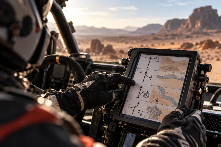
Instead of manually scrolling through paper, crews can move between notes electronically. Modern systems also integrate navigation data, trip information, waypoint functions, and safety features.
Dakar states that its fleet is equipped with an electronic roadbook, with the GPS UNIK IV forming part of the current competitor equipment package.
However, digital does not mean automatic.
FIA regulations still require a different roadbook for every stage, and electronic roadbooks can be controlled through unlock codes linked to the stage-start procedure.
The information still needs to be processed by a human.
In fact, a digital system can make the rhythm faster because the navigator can move quickly between instructions. That makes concentration even more important.
Advance to the wrong note, misunderstand a symbol, or lose synchronization with the trip distance, and the crew can become confused within seconds.
Technology improves access to information.
It does not replace navigation skill.
6. Difficult Notes Can Cost More Time Than a Lack of Speed
Dakar competitors often finish stages separated by surprisingly small margins.
In those situations, one navigation error can be more damaging than driving several kilometres slightly slower.
Carlos Sainz demonstrated that during Dakar 2026 when he and other competitors struggled to locate the correct route around a waypoint. He described repeatedly turning around while searching for the right way during a difficult navigation section.
That is a perfect example of why raw speed is not enough.
A driver may gain one minute through aggressive pace over 100 kilometres, then lose three minutes searching for a waypoint after one incorrect roadbook interpretation.
Motorcycle riders face an even more intense version of the challenge because they must navigate while controlling the bike themselves.
Daniel Sanders explained during Dakar 2026 that tricky notes cost him time and that wind and difficult terrain made it harder to maintain focus on the roadbook.
At Dakar speeds, concentration becomes a performance skill.
7. Opening the Road Makes Interpretation Even Harder
Starting first on the stage can be a major navigation disadvantage.
Later competitors often see tyre tracks created by the vehicles ahead. Those tracks are not guaranteed to be correct, but they provide another piece of information.
The road opener has no such luxury.
Every junction, valley, and off-track section has to be interpreted independently.
That makes navigaton accuracy especially valuable.
The navigator must trust the roadbook even when the surrounding terrain seems ambiguous. If a track appears to continue straight but the roadbook calls for leaving it, hesitation can cost time.
This is also why simply following other competitors is not a reliable Dakar strategy.
Tracks can suddenly split because one crew followed the correct route while another became lost.
Experienced navigators treat tyre marks as evidence, not proof.
The roadbook remains the main reference.
8. Driver and Navigator Communication Can Decide Whether a Note Works
Correct interpretation is only useful if the driver receives the information at the right moment.
A navigator who waits too long to announce a junction may force the driver into hard braking. Calling it too early can make the driver turn at the wrong track.
Timing therefore matters as much as accuracy.
At high speed, hundreds of metres disappear quickly.
The navigator may need to communicate distance, direction, CAP, danger level, and what comes immediately afterward in only a few words.
This is why strong Dakar crews develop very precise communication patterns.
The driver understands how the navigator describes a junction. The navigator understands how much warning the driver needs before braking or changing direction.
That consistancy reduces hesitation.
Over a long stage containing hundreds of notes, saving one or two seconds of confusion at each difficult instruction can become a meaningful competitive advantage.
9. Roadbook Interpretation Is Also Risk Management
Roadbooks do more than guide competitors toward the finish.
They help crews manage danger.
Symbols and notes can warn about hazards, difficult terrain, drops, crossings, narrow passages, or other features where reducing speed is necessary.
Misreading one of those warnings can create mechanical damage or an accident.
This makes navigation closely connected to pace management.
When the navigator is confident about the upcoming sequence, the driver can attack harder. If the notes become complicated or terrain no longer seems to match the roadbook, the sensible choice is often to reduce speed temporarily.
That may cost a few seconds.
Missing the route, hitting an unseen hazard, or damaging the vehicle could cost far more.
Elite Dakar crews therefore use interpretation to decide not only where to go, but how aggressively they should travel there.
Roadbook interpretation remains one of the defining skills of modern Dakar competition.
Electronic displays, GPS systems, waypoint technology, and standardized symbols have made navigation more sophisticated, but they have not removed the human challenge.
Competitors still need to connect distance, CAP headings, terrain clues, waypoint logic, and danger notes while racing through unpredictable environments.
One misunderstood instruction can erase minutes of excellent driving. One correctly interpreted note can keep a crew moving while rivals search for the route.
That is why Dakar navigation rewards preparation, concentration, communication, and judgement just as much as speed.
When you watch the next stage, notice when competitors suddenly slow, change direction, or ignore obvious tyre tracks. Those moments often reveal the invisible contest happening inside the cockpit: interpreting the roadbook correctly before the desert proves them wrong.